Summary
A worthwhile tour to the Scheibe, from where you have a fantastic view of Lake Lunz and the Mostviertel. The route then continues along the edge of the ridge via Scheiblingstein and Bärenleitenkogel to the Herrenalm. The return is via the Herrenalmbach and Taglesbach gorges.
Difficulty
Shortly before reaching the saddle between Scheibe and Scheiblingstein, the terrain becomes very steep. You have to use your hands for balance. To get to the Scheibe, you must overcome a short rock slab. A fall here would be problematic, as there is no protection. Due to these two points, the route is rated slightly higher at T2+.
Arrival
At the starting point of the hike, on both sides of the Taglesbach stream, there are free parking spots for around 20 cars.
Food
Chilled drinks are available year-round at the Herrenalmhütte. Snacks are only available on weekends from Friday to Sunday. Otherwise, there are no water sources along the hike.
Ascent to the Scheibe
It’s been a while since my last mountain hike. Other activities, such as marathon training, made me neglect the mountains. But I long for the panting ascent, the cooler temperatures, the green alpine meadows, and the marvellous views. Today is the day: I want to climb the Scheibe near Lunz.
Brilliant blue sky. The forecast for today is over 30 °C in the valley. Hopefully it will be cooler on the mountain. I set off a little late: It’s already 9:30 am. I should be back by early afternoon, as the loop is not too long.
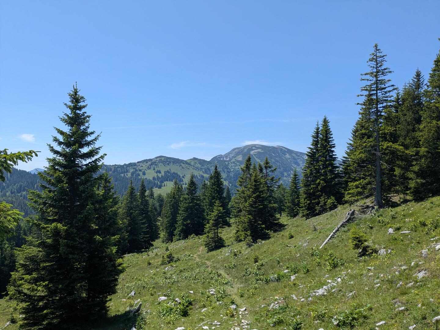
I leave the Taglesbach right at the start of the hike. The unmarked path to the Scheibe and Scheiblingstein branches off to the right. It rained a little yesterday. The area around Lake Lunz is known as one of the wettest regions in Austria. Many rivers and streams have their source here.
My shoes slip a few times on the damp, steep forest floor. The cleats dig into the soft ground. Although unmarked, the path through the forest is easy to follow. But it is almost always steep, heading straight uphill. Flat places to rest are rare on this ascent.
I cross a forest road three times - each time a good opportunity for a short break. At the last crossing, I follow the road briefly to the next trail entrance. If you miss it, no problem. The path runs parallel to the road, and there are further opportunities to rejoin it.
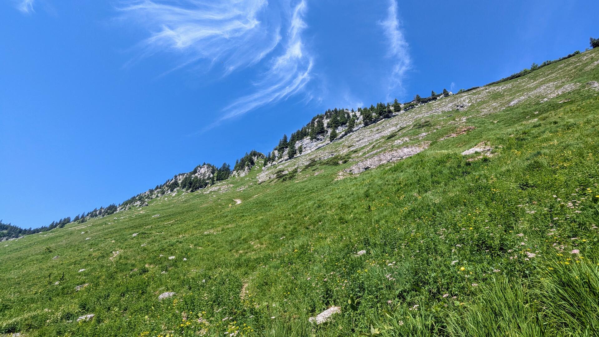
Soon afterwards, at around 1300 metres, the forest thins out and my destination, the saddle between Scheiblingstein and Scheibe, comes into view. Phew, it gets even steeper here.
A hiker carefully makes his way down from above. He has already been to the top. I wait at a convenient spot and let him pass. The path winds ever more steeply in short hairpin bends up to the saddle. Up to 60% gradient according to my map. In some places, I use my hands for balance. Sweat drips from my chin.
Scheibe Summit
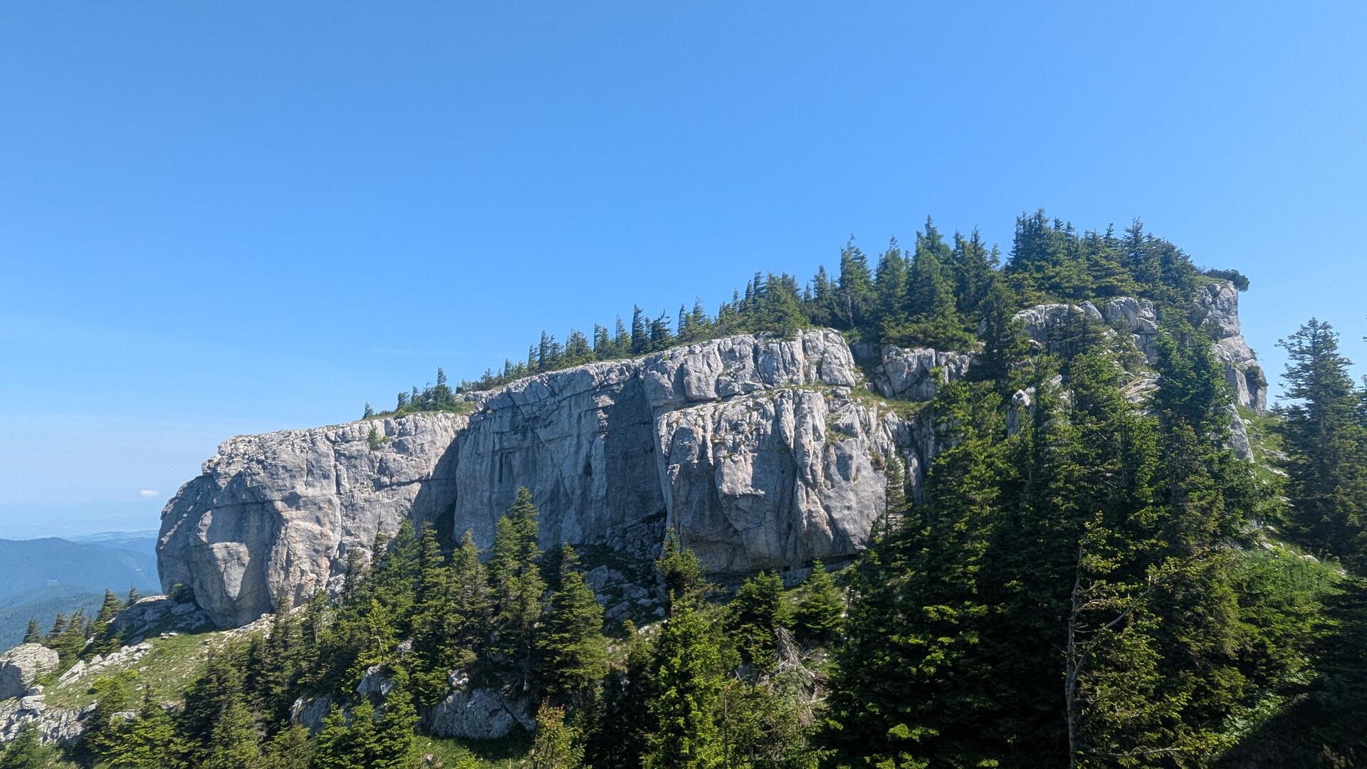
I made it! The last section before the saddle was the steepest. The cliffs of the Scheibe form a flat plateau, covered with mountain pines. But how do I get up there? Only by climbing a short rock slab. A bit of surefootedness is required. Once at the top, the path branches: left to a viewing platform for Lake Lunz, right to the summit.
 />
/>
 />
/>I choose the right one. A mistake, as I later realise, since I miss the turn-off on the way back. An elderly gentleman comes towards me from the summit, barefoot and cheerful. Only two hikers so far. Not much going on today.
I choose the right branch—a mistake, as I later realise, since I miss the turn-off on the way back. An elderly gentleman comes towards me from the summit, barefoot and cheerful. Only two hikers so far—not much going on today.
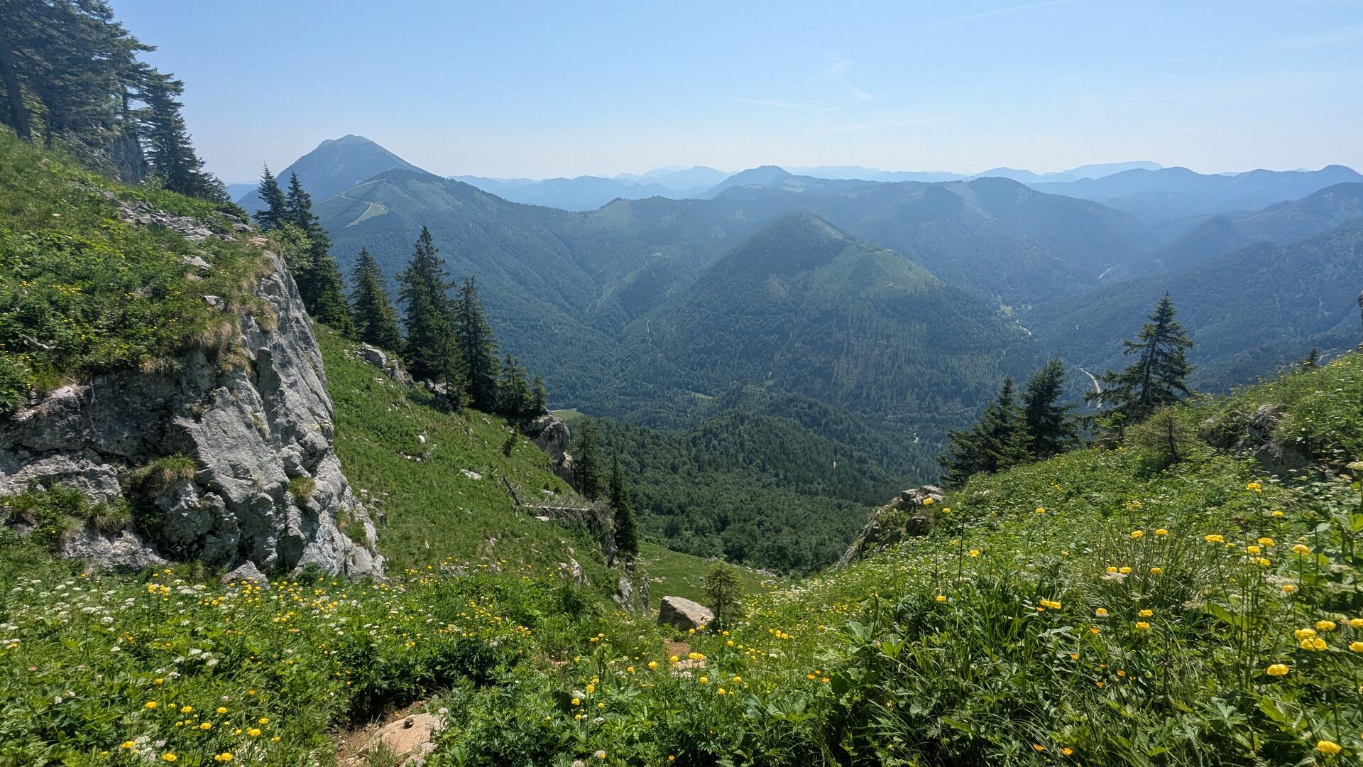
I take a short break at the summit and enjoy the marvellous panorama over the foothills of the Alps in the Mostviertel. The Ötscher and the Gemeindealpe are also visible.
Herrenalm
I haven’t reached the highest point of my hike yet, but it’s not far off. The next section is more relaxed but also offers great views over the Oistal valley. I walk along the ridge to the Scheiblingstein, which is only slightly higher.
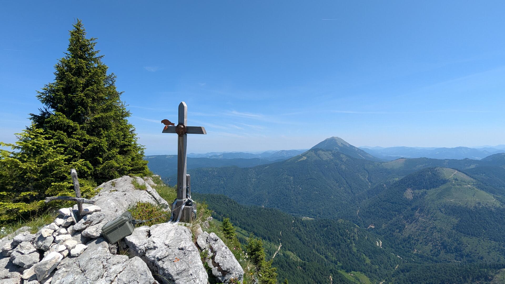
This is followed by a longer section, always slightly uphill and downhill, to the Bärenleitenkogel, the highest point of this hike. The inconspicuous summit crosses on these mountains usually consist of just two branches tied together.
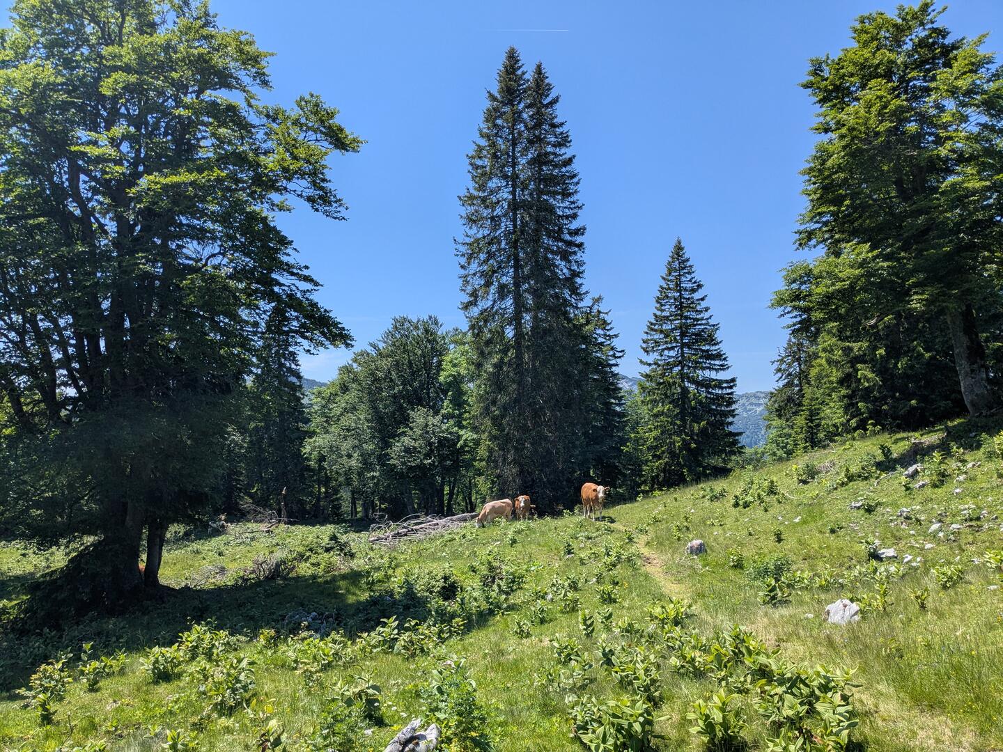
After the last summit, the path turns more into the forest and you pass the fence of the Herrenalm. Here, the path becomes less distinct in the alpine meadow. It’s best to follow the well-trodden cow paths. The terrain is no longer difficult. Numerous flowers give the meadow a colourful character: yellow globeflower, purple wood cranesbill, and white, rough-haired scabious.
I can hear the tinkling of cowbells from afar, even before I see the first cow. They are resting in the shade of the trees or grazing in the meadow. Some of them have chosen my path. No problem. I go round them.
 />
/>
 />
/>It’s not far to the Leonhardi cross. I still have to pass a few fence gates, and then the cross with its view of the Herrenalmhütte awaits me. I passed this cross two years ago when I hiked from Dürrenstein to Obersee. Today, however, I head down the other side to the hut.
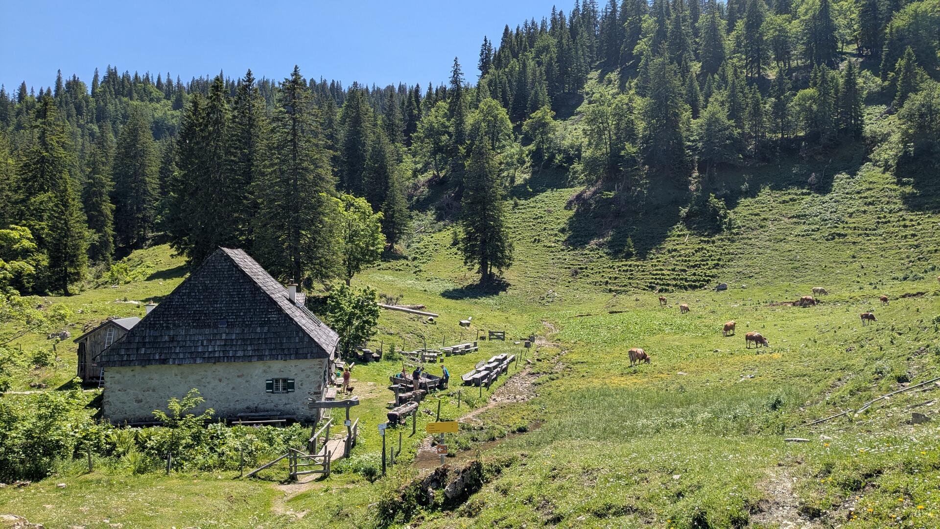
Herrenalm Hut
More cows on the mountain pasture and a group of hikers resting on the benches in front of the hut. Snacks are only available at weekends, only chilled drinks are always available at the hut. You can also spend the night here.
Truly idyllic. The rushing Herrenalmbach stream drowns out all other sounds. The stream tumbles down into the gorge next to the hut over a few short waterfalls.
As I walk downhill, I can hear the sound of the water the entire time. Later, the Taglesbach joins in. However, I can hardly see either stream—they flow too deep in the gorge. Only towards the end, down in the valley, do I finally see the Taglesbach.
The way down is quick, but I have to be careful. The path is used to drive the cows up to the alpine pasture and has been heavily trampled by their hooves. It’s incredible that they manage to climb up here one after the other.
