I arrive a little late in the Steinbach valley at the Rotschild pond. It’s almost midday. The sun is still heating up the area, but the weather is uncertain for late afternoon. Rain or even thunderstorms are forecast. So I have to hurry. The planned route is quite challenging:
I want to go from Steinbach valley to the Tremel pass. It sits quite high at 1200 metres. There are definitely easier ways to cross into Styria. But I don’t want to pass it, but rather hike along the ridge between Hochkar and Dürrenstein, basically following the border, to then finally climb Dürrenstein from the south.
As I said, not the easiest tour and also long. With a return via the Ybbstaler Hütte, I will have to cover around 25 kilometres.
Steinbach valley
Hunting Lodge Steinbach
The first few kilometres are pleasantly flat on asphalt and then later on gravel. I pass a few pretty wooden houses. However, they don’t quite fit in with the rural architecture of the rest of the region. They remind me more of the alpine chalets in Switzerland.

This is no surprise, as the ensemble was built in this style in the late 19th century together with the Steinbach hunting lodge for Baron Albert von Rothschild.
Baron Rothschild had previously acquired the forests around Dürrenstein. A stroke of luck for nature because, as an enthusiastic hunter, he reduced forestry work in order to protect the game of the area. As a wealthy banker, he was not dependent on the income from logging. In this way, he also preserved one of the last primeval forests in Austria, the Rothwald, which remained untouched by humans until today.
Unfortunately I couldn’t take any pictures of the luxurious hunting lodge, maybe another time.
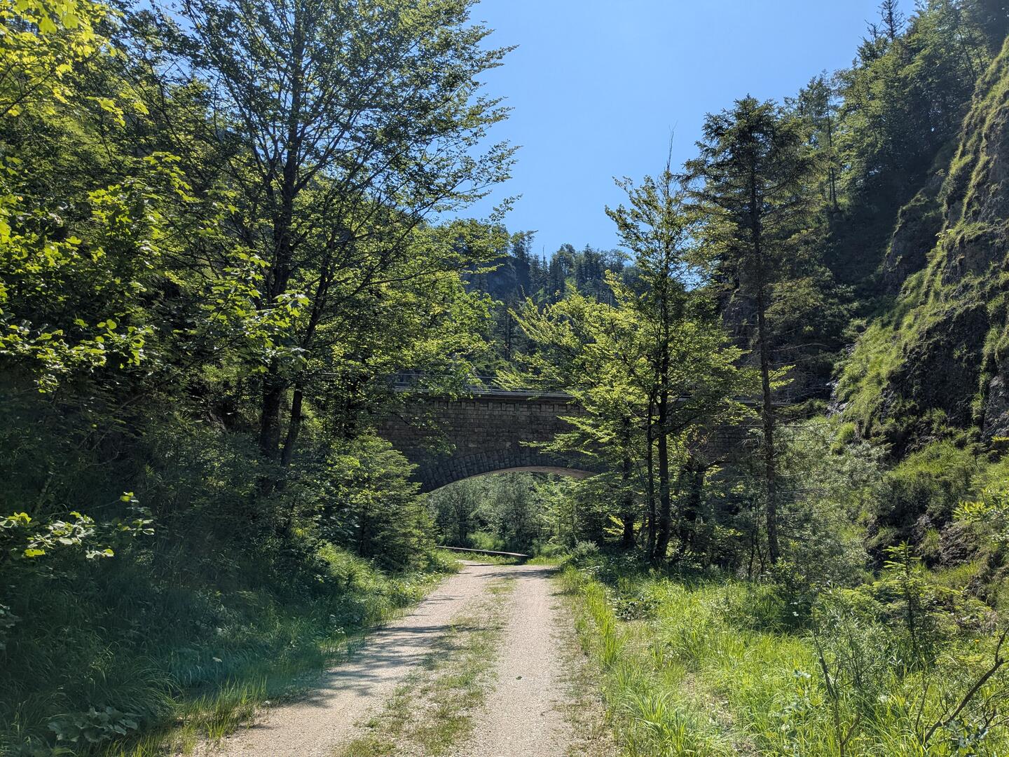
Vienna Mountain Spring Pipeline
On my way deeper into the Steinbach valley, I also walk through numerous aqueducts and tunnels. They carry Vienna’s drinking water. The 2nd Vienna Mountain Spring Pipeline has its source a little south of here, in the Hochschwab. The water reaches the Steinbachtal valley via the Lueger tunnel, which cuts through the mountain range in front of me.
 />
/>
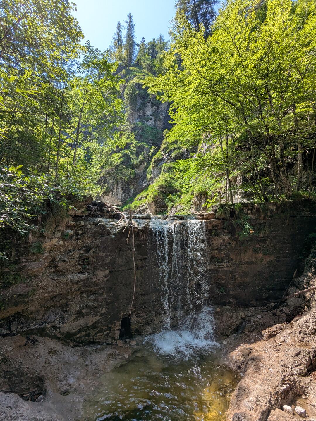 />
/>The water in the Steinbach stream is also wonderfully clear. I would love to cool my feet. It looks incredibly refreshing. I cross a small bridge at a waterfall. The gorge ends. From now on, I have to find my way uphill.
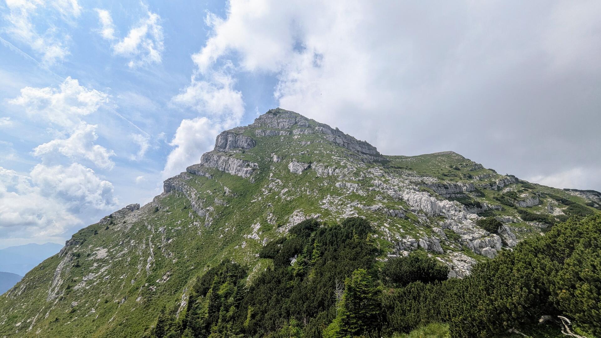
Dürrenstein South Ascent
Tremel
The start of the path is initially somewhat hidden in the vegetation. But once I found it, I quickly gain height. I rise from the streams in the valley via an small, washed-out path.
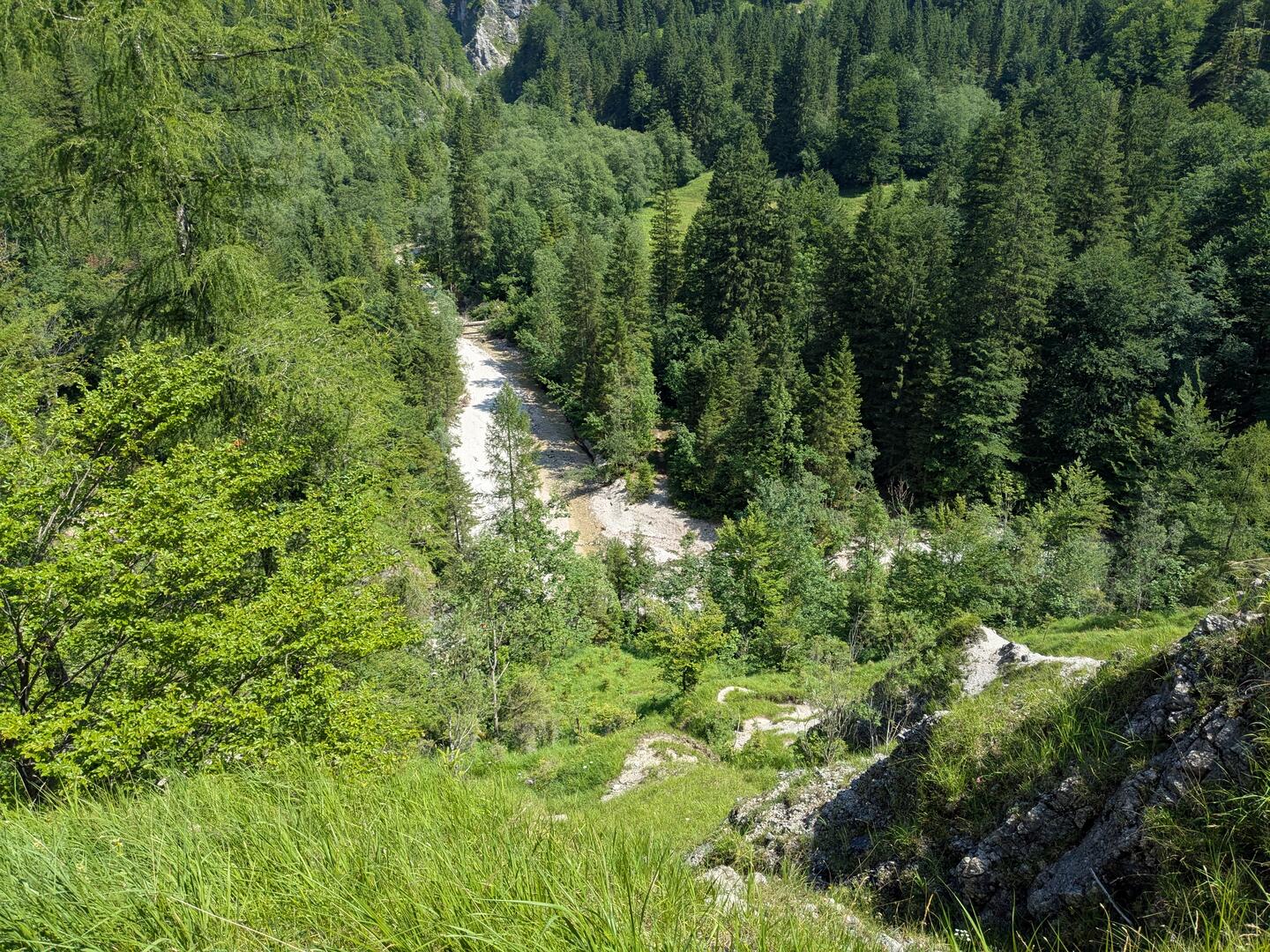
There are around 550 metres to climb in just 2.5 km - the first challenge of the day. And the Tremelsteig, as I call it, also offers numerous difficulties. A few fallen trees require different routes. Anything but easy in the steep, impassable terrain.
I have to use my hands a few times to keep my balance. There are even safety ropes in particularly tricky places.
My surefootedness is required when crossing a wet gully. Two pins are carved into the rock. They are wet from the water pouring down. The first one done and the second follows immediately - almost like a via ferrata 🤣
Towards the end, the path becomes flatter again and I find myself in front of an inconspicuous sign: Tremel ☺️
Alpin Trail
I hear voices. A hiking group is descending from the Gamskogel. Are they taking the same route as me? Anyway, onwards.
Shortly after the Tremel, I overtake a single hiker. He is chatty, has also taken the path over the Steinbach and wants to go a little further to the Hochkirch. He doesn’t have the energy or time for the long round to Dürrenstein. He will go back down the way he came.
Due to its length, the ridge path between Hochkar and Dürrenstein is not used very often and the path gets occassionaly lost in the terrain. It is best to stay on the top of the ridge, therefore. A few border stones between Lower Austria and Styria also mark the path up to Hochkirch in even spacing.
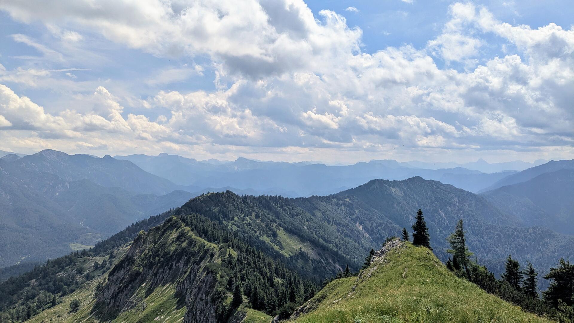
At Hochkirch, the border then drops down to the Lassing stream. The unusual border, which leaves the ridge here, originated from to the possessions of the Gaming Carthusian monastery. Its territory extended to the forests south of the Dürrenstein, the Rothwald.
However, the monks were unable to access the forest. It was too difficult to transport the tree trunks over the ridge. The easiest way would have been drifting them down the Lassing stream, but Admont Monastery forbade its usage. Admont, which ruled over the majority of the forests in northern Styria, also laid claim to the densely wooded areas south of the Dürrenstein and tried to force the sale by banning this form of transportation. But the monks in Gaming remained stubborn.
The dispute between the Gaming and Admont monasteries made it possible to preserve the primeval forest for centuries. Today, it forms the core area of the Dürrenstein-Lassingtal Wilderness Area and is part of the UNESCO World Heritage Site “Primeval Beech Forests of Europe”.
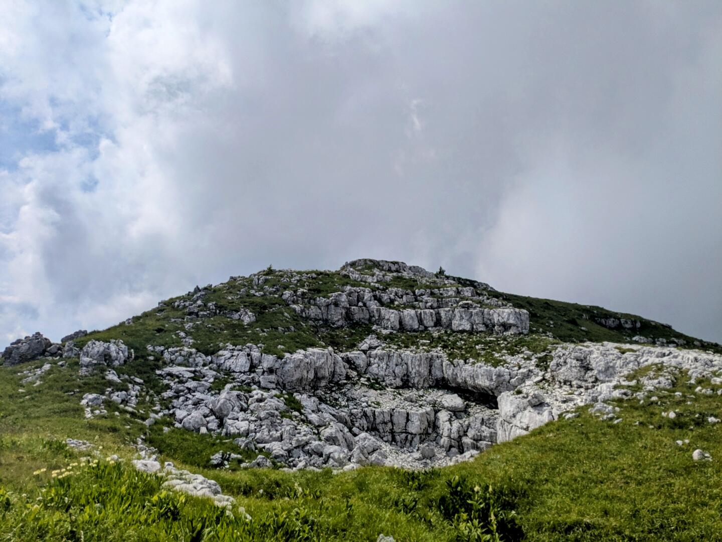
Sperrriegel
I slowly fight my way towards Dürrenstein. Its cliffs get closer and closer. Up and down. A chamois runs in front of me. Oops, it’s gone. But it has left something for me: a small black pile of 💩
To my surprise, however, the pile meanders away as I step closer. It could be a black grass snake. Black ones are really rare. Unfortunately, it quickly disappears into the bushes and I don’t dare to look for it, even though they are completely harmless. But I’m not the bravest around snakes 🐍
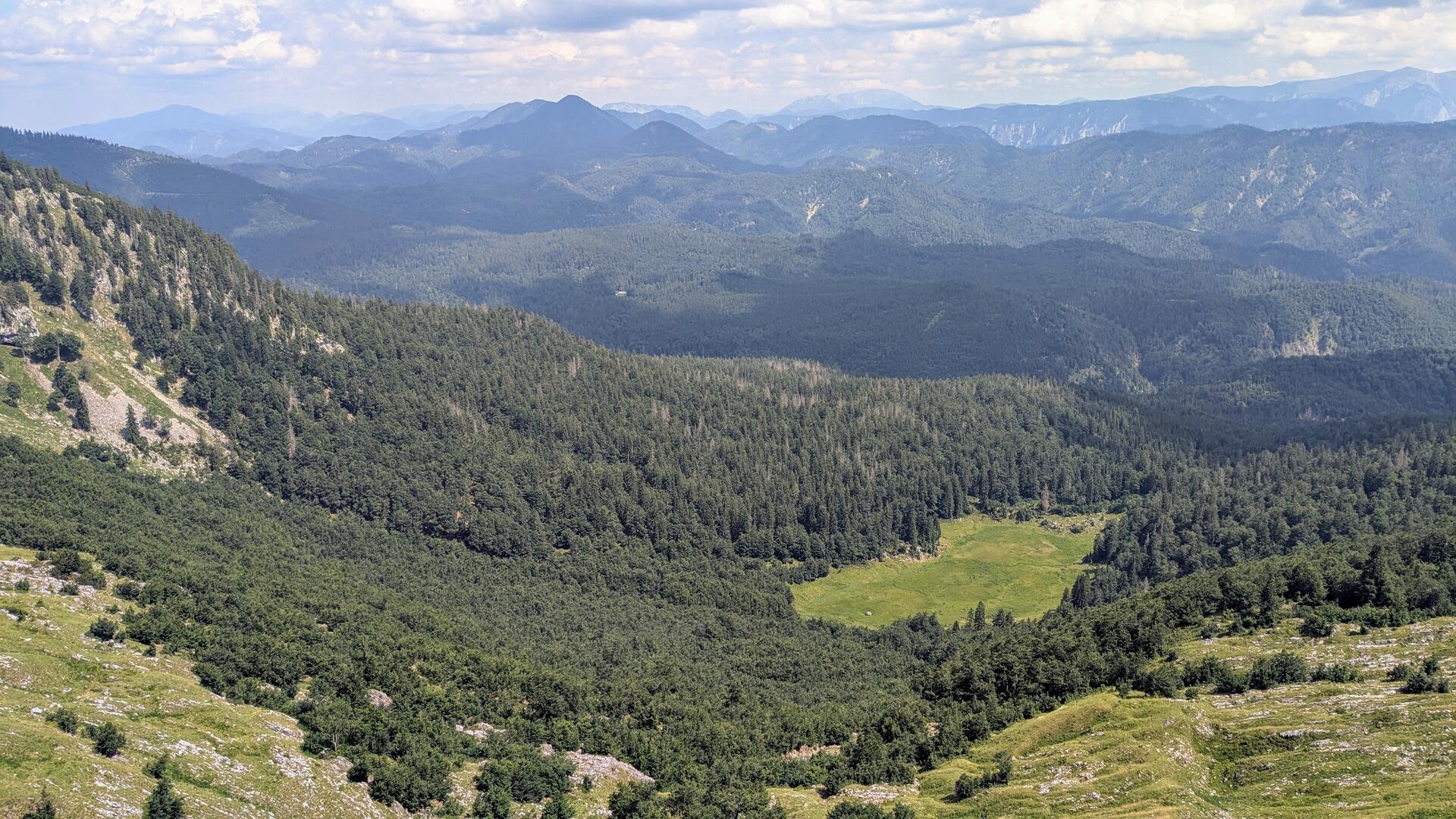
The forest thins out more and more. Without the tall spruce trees, I enjoy a marvellous view into the Lassing valley and over the Rothwald forest. The Bärwiesboden, a moor in the Rothwald, is also perfectly visible from here. I rest for a while, drink the last drops of my water reserves - there hasn’t been a water source along the way since Steinbach valley- and the summit assault can begin.
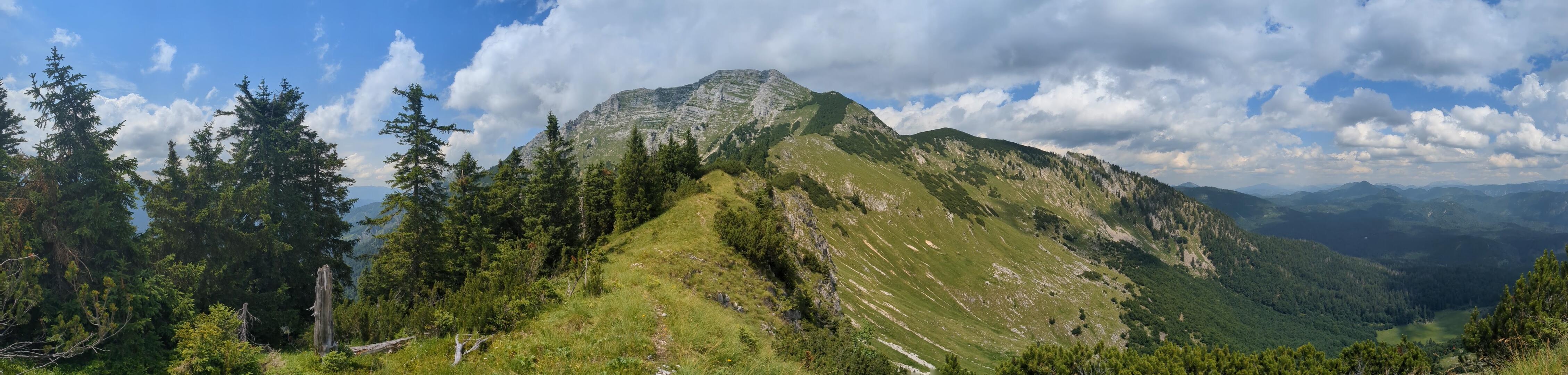
I set off with renewed vigour, but after a few metres I have to pay tribute to my pace. A short break is in order. The climb is steep. The path is not always recognisable. But I shouldn’t have any problems orientating myself. The summit is in sight and so is the mountain flank. The direction is also marked with red paint on rocks at regular intervals.
A small group of hikers winds its way up the mountain in front of me. Slowly but steadily, I catch up with them. They rest at a crest. No conversation this time. They are out of breath - and so am I.
 />
/>
 />
/>The pyramid of the summit towers up in front of me. The ornate Töpper cross is already in sight. The terrain becomes flatter. Just a few more rock steps to scramble over and I’m standing in front of the cross.
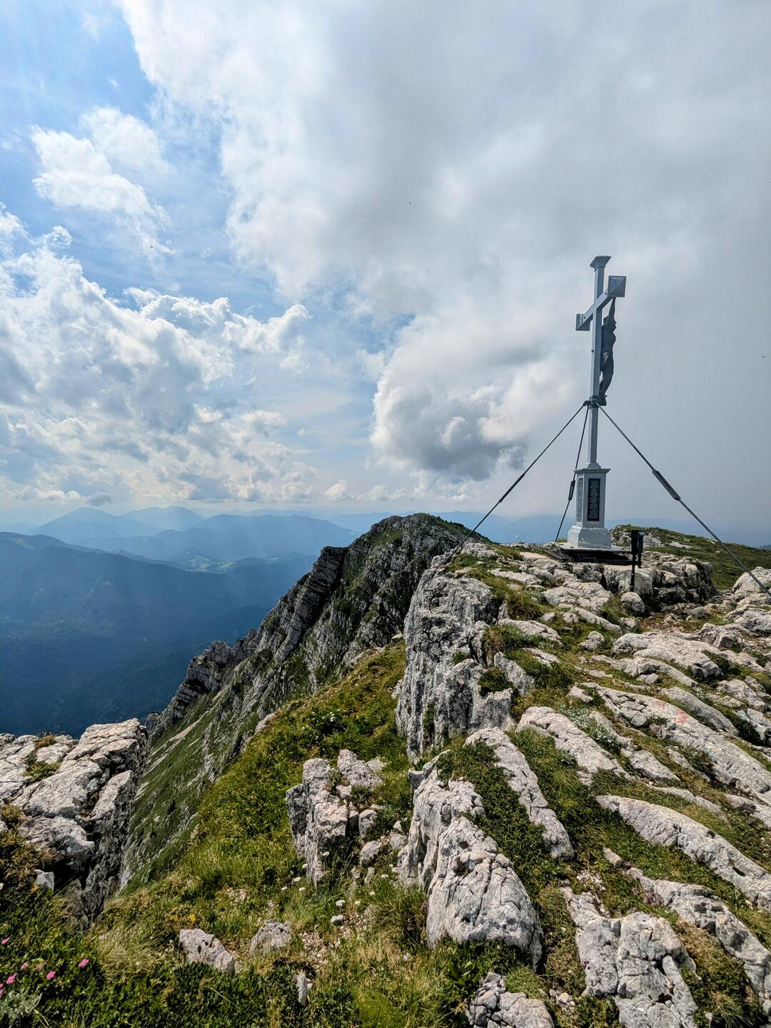
Summit
Another surprise: I have the summit to myself, despite the weekend. On my last ascent two years ago, things looked very different. Numerous hikers were resting at the summit back then.
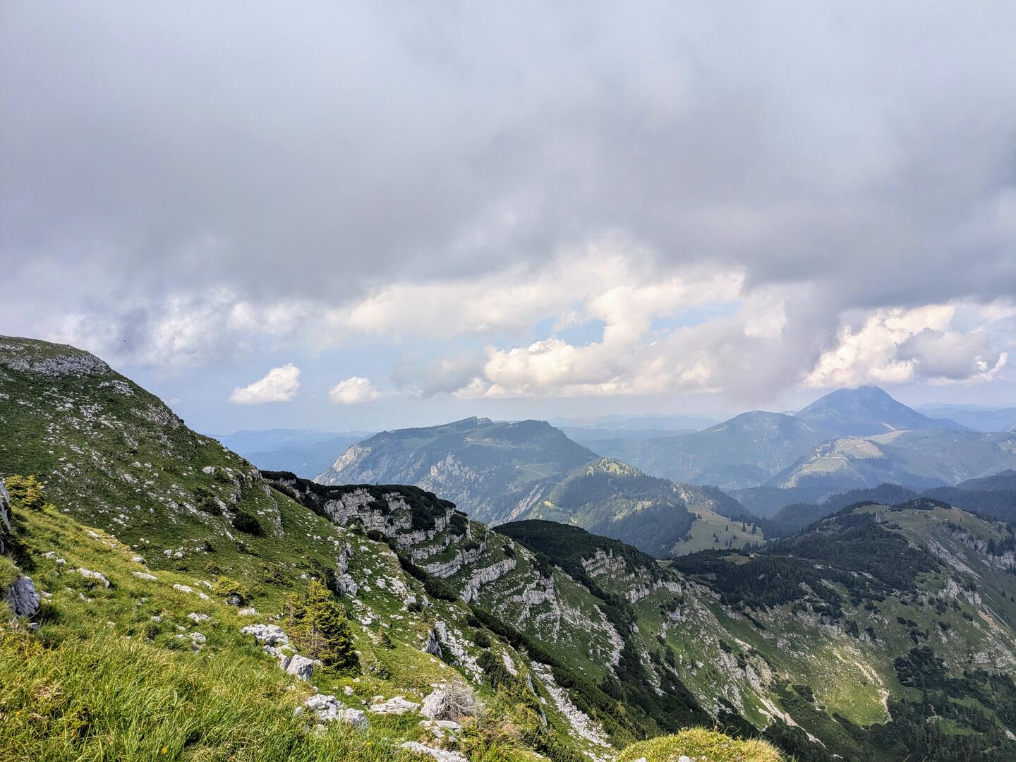
Today I’m a little late and the rain warning for the afternoon has probably put some people off. Dark clouds were also my constant companion on the hike. They alternated with bright sunshine. Now at the summit they cast a shadow again.
So I don’t linger for long. I don’t want to get wet at the top of the mountain. My water supply has also run out. There is a spring a little below the summit and the Ybbstalerhütte is not that far away. So no big problem.
The descent is less spectacular, which is why I refer you to my blog post from two years ago. I take the same route to the Ybbstalerhütte, but this time downhill instead of uphill. After the hut, it’s straight back to Steinbach valley via an easy hiking trail.
Fact sheet
Abstract A challenging and scenic circular tour to the Dürrenstein via the southern flank through the Dürrenstein wilderness area. From Steinbach valley, the Tremel pass is ascendet and then the ridge is walked along to Dürrenstein. Return via the Ybbstalerhütte.
Arrival Car parking is available at the Rotschild pond in the Steinbach valley.
Difficulty The tour requires surefootedness. The ascent to the Tremel is steep, although tricky sections are secured and equipped with climbing aids. The ridge and the ascent to Dürnstein are partly pathless. Some sense of orientation is therefore required.
Catering There are hardly any opportunities to stop for refreshments or water along the way. Just below the summit is the Legstein spring. And at the Ybbstalerhütte you can only stop for refreshments on the descent.
